Tsunami disasters, housing relocation, and land use pattern
The 2011 East Japan Earthquake Bulletin of the Tohoku Geographical Association
9 April, 2011
Gen Ueda, Associate Professor, Tohoku University
Email:gen-ueda(a)m.tohoku.ac.jp
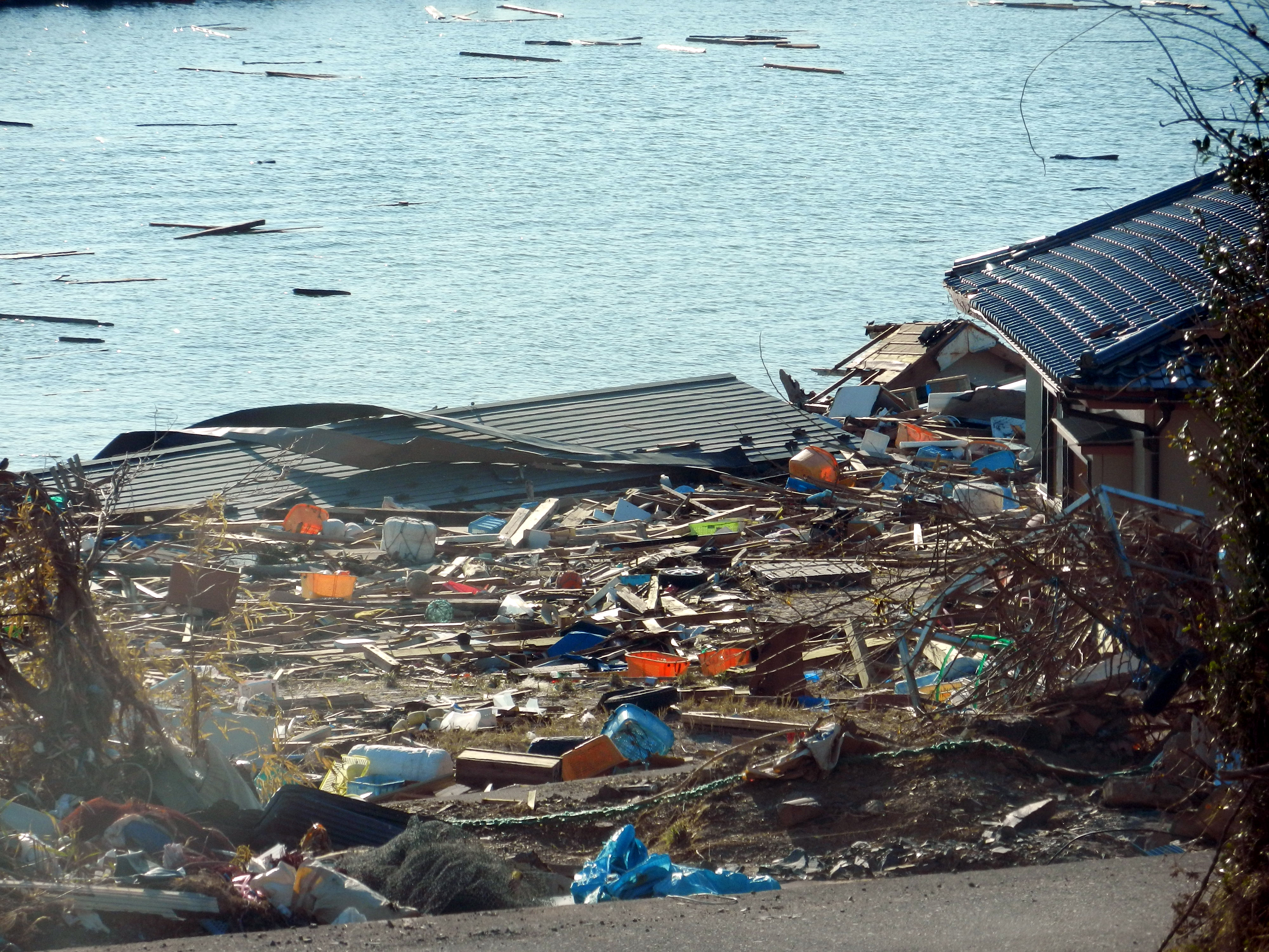
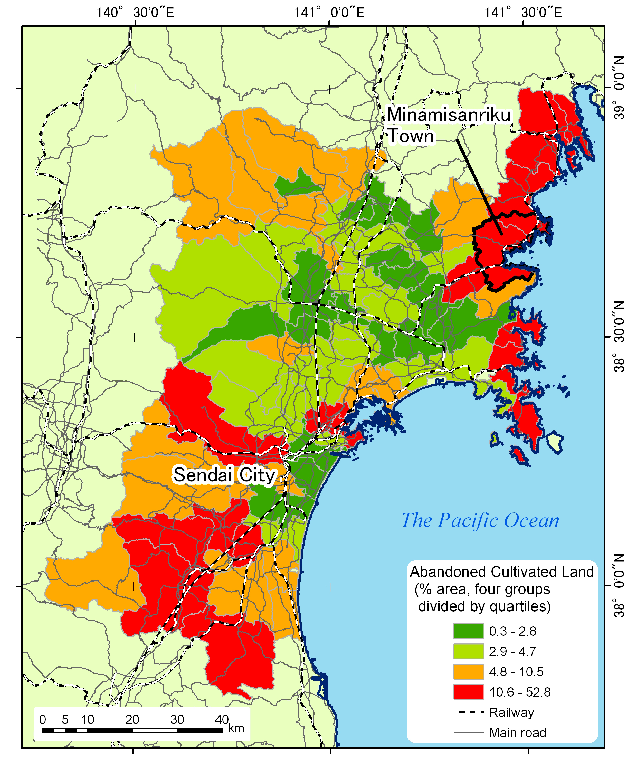
Relocation of housing from the tsunami- devastated lowlands near the seashore (Photo 1) to elevated land is among the ideas that will be discussed in a government-convened council of officials from the quake-hit regions and city planning experts1. The housing relocation in the Sanriku coastal areas will change the land use pattern of the elevated areas presently with the combination of homesteads, cultivated fields and forest plantation. Abandoned cultivated land in these areas is a possible location for settlement reconstruction. Especially since the early 1990s, the abandoned land has expanded in the process of rural depopulation and ageing. In Miyagi-ken (Figure 1), one of the Prefectures devastated by the 2011 East Japan Earthquake, the abandoned cultivated land started to expand in its southern part where upland farming is more prevalent and the area of farmland per agricultural household is relatively small. In north Miyagi, while paddy rice cultivation has slowed down the field abandonment to some extent, the Sanriku coastal area with the southern edge of Kitakami Mountains has undergone substantial upland farm abandonment where paddy cultivation is minimal. The percentage of abandoned land to the total farmland was very high in the former Utatsu Town (33.8% in 2005), now a part of Minamisanriku Town (population in February 2011: 17,666), which was among those hardly hit by tsunami. In its Tomarihama settlement (about 600 residents), wheat price decrease after the mid 1980s accelerated field abandonment, and fishery and guest-house management for tourists became more important, thus expanding abandoned fields2.

|

|
| Photo 1: Seashore houses destroyed by tsunami, Tomarihama, Minamisanriku Town, 6 April, 2011 (by Gen Ueda) | Figure 1: The abandoned farmland area as percentage to the total land owned by agricultural households by former local government jurisdiction, Miyagi Prefecture (Census of Agriculture and Forestry 2005) |

|
|
Photo 2: Conversion of abandoned land to sunflower field, Tomarihama, 6 April, 2011 (by Gen Ueda) This upland parcel was free from the tsunami strike. It was full of sunflowers in the summer of 2010. |

|
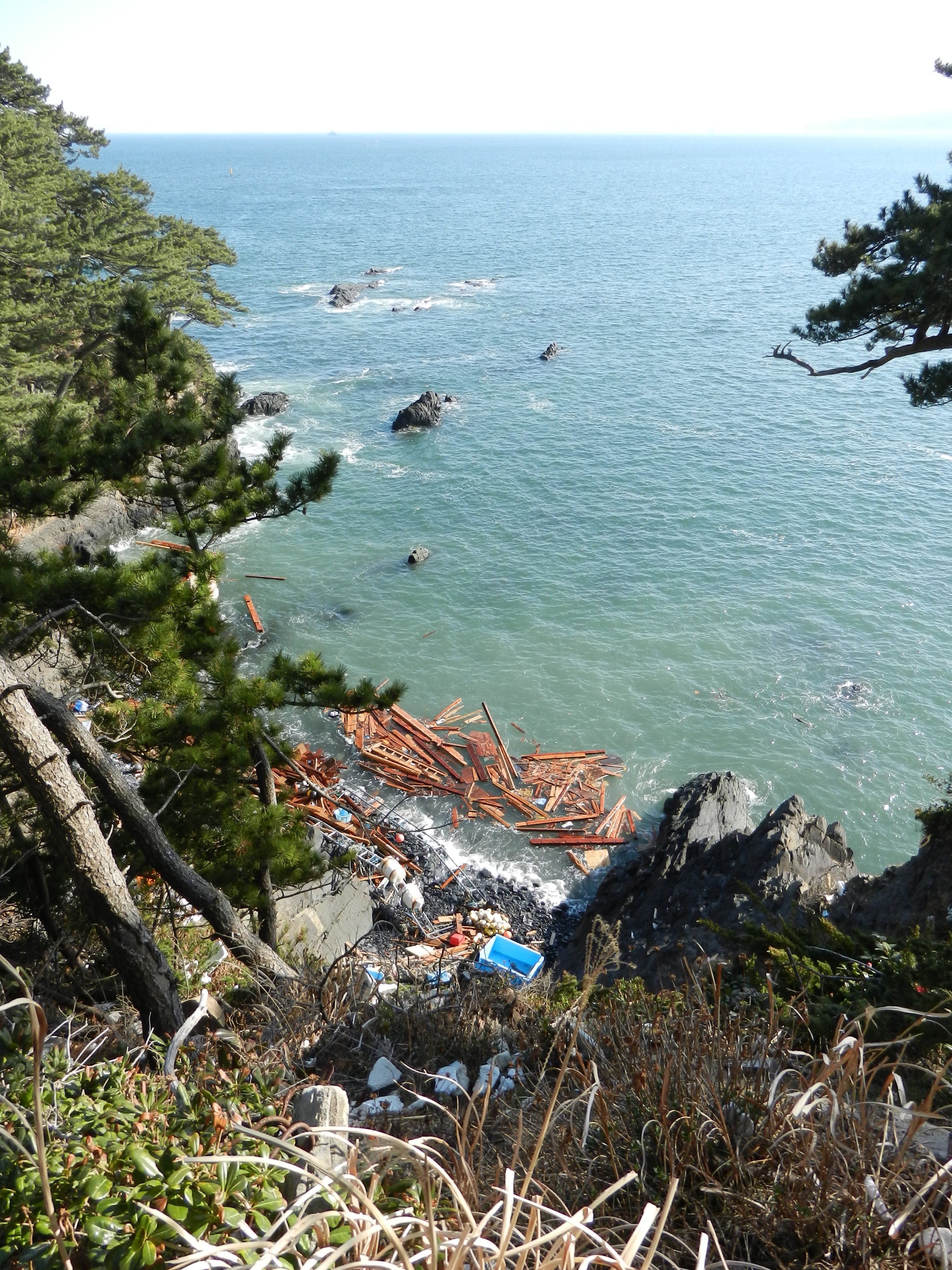
| Photo 3: Floating debris of wooden structures and fishing gears from the tsunami-hit shore in its otherwise very lovely scenery of the Pacific Ocean, Tomarihama, Minamisanriku, 6 April, 2011 (by Gen Ueda) |
The local people began to alleviate the socio-economic and environmental problems created by the field abandonment. Some let non-residents use their abandoned land free of charge for feed crop cultivation. In addition, a local government subsidy was granted for landscape improvement: the people planted sunflowers in a part of abandoned field that started to attract tourists who would admire the landscape of gsunflower cape,h and held gthe first Tomarihama Sunflower Festivalh in the summer of 2010: a beautiful scenery with flowers is still accessible from the townfs web site3. The tsunami did not affect the upland field (Photo 2), but the possible housing relocation from the destroyed seashore areas might change the land use and landscape of the upland. The death toll is yet to be precisely known, but that should be quite many. Approximately 9,500 people were evacuated mainly from seaside residential areas in tsunami-hit Minamisanriku Town (Photo 3), and some of them seek collective refuge even to other towns and cities for some months before completion of temporary dwelling units4. The locational decision concerning these substantial temporary structures and relocation of permanent housing at a later stage may change the land use and ownership. The local people may also need a new livelihood strategy when they loose one of their tourist attractions in the upland, the gsunflower cape.h
Note